
Finding a Redondo Beach Street Directory Trail
An address search in Redondo Beach should move through identifiers in a fixed order. A street directory can show a parcel, a recorded party, a permit event, or a dated listed subscriber, but no single source is a household roll. Start with the full address, keep the assessor's normalized spelling, and record the date of each result. The strongest street trail keeps ownership, occupancy, and public registration in separate columns. That distinction matters in South Redondo, North Redondo, and older tract areas where a postal label, parcel, and historical address may not line up.
- Run the address through the Los Angeles County Assessor Portal. Save the situs address, AIN, tract or lot detail, and the parcel facts that identify the right property.
- Open Map Search and pan along the same street. Click each parcel instead of treating a map view as a complete street export, then keep one row for each AIN and situs.
- Translate the parcel into a recorder request. The RR/CC needs an indexed party name and recording year, so use the current ownership information that can be obtained from the parcel trail to identify a likely grantee.
- Use the California and Los Angeles County voter tools only for a voter's own status or a lawful, purpose-gated file request. They do not provide a public by-street roll.
- Check a held telephone book or reverse section only for the year and volume that actually contain one. A dated subscriber or occupant listing is useful context, not proof of who lives there now.
The result is a street-by-street evidence path: address to parcel, parcel to legal description, legal description to a name and year, then a dated cross-check. A name that appears in only one source stays marked as a single-source result.
Search Redondo Beach Addresses
The Los Angeles County Assessor Portal is the first stop for the address side of a Redondo Beach street directory. Its public search accepts an AIN or an address, not an owner name. An AIN is the assessor identification number for a parcel. The number has ten digits and is displayed in a four-three-three pattern, so preserve the digits and the displayed grouping when copying it into notes or a later request.
| Field Label | Type | Required | Format and Use |
|---|---|---|---|
| Search by AIN or Address | Autocomplete text | Yes | Enter the ten-digit AIN or choose a normalized address from the suggestions. |
| Map Search | Spatial mode | No | Pan and click individual parcels; a street-wide table export was not verified. |
A parcel result can expose situs, use type, parcel status, tax-rate area, units, building and land measures, built and effective years, roll values, legal tract or lot description, and parcel-map links. Tabs include Summary, Ownership, Parcel Change, Parcel Map, Roll Detail or Real Property Value, and Building or Land Characteristics. The inspected public page did not plainly show a verified owner-name or owner-mailing-address field. Do not turn a tab label into a claim that anonymous name search is available.
Use the portal to normalize the place before following any name. A corner parcel may sit against another street, and a multi-unit property may have more than one AIN. The situs is the physical assessed location. It is not automatically the mailing destination, the legal description, or a list of people at the address.
Pan Parcel by Parcel Along a Street
Map Search gives the Redondo Beach street directory a way to move laterally. Pan to the target segment, click the first polygon, save its AIN and situs, and then repeat for the parcels that touch or face it. The map is a parcel inspection tool. It is not an occupant map, and the accessible interface did not verify exact layer names, a buffer tool, or a radius setting.
Keep the entered address, the normalized situs, and the parcel geometry in separate fields. A street number can be reused by a unit, a rear structure, or an older address form. The legal tract and lot help resolve those conflicts. If the map opens a parcel detail page, compare the full legal description and not just the street label before joining two rows.
GIS also helps identify where a street search changes jurisdiction. South Redondo, the original townsite, Clifton-by-the-Sea, Redondo Villa, North Redondo, and Hollywood Riviera are useful local clues, but a neighborhood name does not replace the assessor's parcel identity. When the map does not expose a needed layer, note the gap and use the records request route for the custodian instead of guessing.
Redondo Beach Records Searchable by Street
Several Redondo Beach record sets can be reached from an address, but each answers a different question. The street directory becomes reliable when its source column states whether a row describes land, a recorded transaction, a building event, a dated listing, or a registration record. The county recorder is the key exception because its real-estate system is held from 1850 to the present but is not searchable by street address or APN.
| Address Record | What It Adds | What It Cannot Establish | Access |
|---|---|---|---|
| Assessor parcel | Situs, AIN, legal tract or lot, improvements, values | A complete household or a verified public owner-name search | Free address or AIN portal |
| GIS parcel map | Parcel geometry, adjacent parcels, map context | Occupants or a confirmed street export | Free Map Search, click by click |
| RR/CC real-estate record | Grantor, grantee, date, document number, legal description | Address/APN searching or current residence | Name and year request, paid copies |
| City permit file | Permit, address, contractor or applicant, work chronology | A transfer or a full resident chronology | Permit search or city request |
| Directory or telephone book | Listed occupant or subscriber in a named year | Unlisted people or missing years | RBPL, digitized, or LOC holdings |
| Voter record | Registration information for an authorized requester | A public list of everyone on a street | Personal status tool or purpose-gated file |
Parcel data can bridge to a deed request. A permit can date a physical change. A directory can place a person at a location for one year. A voter file, when lawfully available, has its own statutory limits. None should be silently merged into “current residents.” That is the central discipline of a Redondo Beach street directory.
Separate Redondo Beach Address Terms
Address words carry legal and practical meanings that are easy to blur. The assessor's situs is the physical place being assessed. A mailing address is where notices or returns go, and it may point to a person, entity, manager, post office box, or another property. A legal description identifies the surveyed interest being conveyed. Occupancy describes use of a place, which can differ from ownership and may never appear in an address record.
- Parcel
- A land or unit record identified by an AIN. Parcel boundaries and legal descriptions are stronger matching clues than a repeated street number.
- Situs address
- The physical assessed location. It is not a promise that the owner receives mail there or that a listed person resides there.
- Plat
- A subdivision or tract map that supplies lot, block, street, and boundary context for a legal description.
- Criss-cross directory
- A street-order or address-order section in a historical directory, when that particular volume includes one. It turns a name search into a dated address clue.
- Occupancy
- Use of a place by a person or household. A deed, exemption field, or mailing line does not by itself establish occupancy.
These distinctions explain why one source cannot answer every street question. A deed identifies parties to an instrument. A permit identifies an application or work event. A directory identifies a printed listing. The most careful address worksheet preserves the source label next to every name.
For a historical match, retain the exact printed street form and the modern normalized form. If the two differ, the difference is a research question. It may reflect a tract boundary, an annexation, a map convention, or a spelling change. No authoritative citywide Redondo Beach renumbering date was found, so a clean-looking conversion should not be invented.
Why Redondo Beach Deeds Need a Name
The Los Angeles County Registrar-Recorder/County Clerk Real Estate Records office holds deeds, deeds of trust, leases, liens, defaults, trustee-sale notices, plats, and other instruments from 1850 to the present. It does not start a search with a Redondo Beach street address or APN. The request needs a document number, or indexed grantor or grantee name together with a recording year and document title. That limitation is the most important quirk in the county side of a street directory.
The Los Angeles County public-records request routing page is the source for the county request path shown in the first record image.
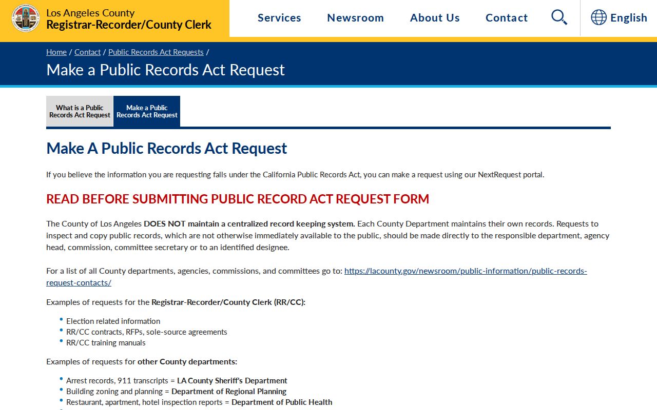
The image points to the county routing step, not to a street export. Real Estate Records is at 12400 Imperial Highway, Room 2207, Norwalk, California 90650. The office lists 800-201-8999, option 3, and recorder@rrcc.lacounty.gov. Orders may take about 20 working days, so a request should preserve the search name, year, title, and any no-record response.
Search cost and copy cost are separate. The research notes a $0.50 name-and-year search, plain copies at $5 for the first page plus $3 for each additional page, and certified copies at $6 for the first page plus $3 for each additional page. The RR/CC real-estate records FAQs explain the grantor and grantee indexing rule. If the year is unknown, use parcel change information, a directory bracket, a permit chronology, or another dated clue to narrow it before ordering.
Build a Redondo Beach Deed Chain
Once the assessor has supplied a likely current name and parcel context, the deed trail moves backward through indexed parties. A grantor conveys an interest; a grantee receives it. The names alone are not enough. Compare recording date, document number, legal description, parcel reference, and the type of instrument at every step. Trust deeds, reconveyances, quitclaims, notices of default, and trustee-sale notices do not all mean the same thing as a completed sale.
- Write down the current AIN, situs, tract or lot, and the legal description that matches the target parcel.
- Request a likely acquisition deed by grantee name, approximate recording year, and document title through RR/CC.
- Read the grantor, grantee, recording date, document number, APN when present, and legal description. Keep execution date separate from recording date.
- Search the seller as an earlier grantee and repeat only when the legal description continues to match. For a common name, compare co-parties, dates, entities, and parcel language.
- Test ownership against a dated directory, census, permit, or newspaper entry. A deed proves an ownership transaction, not who used the address as a home.
The Los Angeles County parcel detail example shows the sort of assessor record that anchors a deed request.
A parcel detail screen can help match tract, lot, building, and roll facts, but it does not make the county recorder address-searchable. When an instrument names a trust, LLC, or estate, preserve that legal party rather than changing it into a person without a source. A return or “when recorded mail to” line is a mailing field. It is not automatic proof of residence.
Redondo Beach Permit Records Date Change
Redondo Beach Building and Safety instructions identify three permit search fields: Permit #, Parcel Address, and Primary Contractor. When the interface directs address users to search with the house number alone, enter that number first and then validate the full address on every result. A permit can identify work, an applicant, a contractor, and a date. It cannot prove a sale, a complete building history, or a person’s residence.
Historical permit holdings from 1913 through 1991 are documented through the museum and building records, but the current permit portal's full coverage and stable index were not verified. That gap matters for a street directory. A blank current search is not proof that no older permit exists. The practical fallback is a focused city request with the address, likely year, permit type, and the exact record sought.
For city-created files, the City Clerk at 415 Diamond Street receives requests and lists 310-318-0656. The city form asks for the requester's name and contact details, a specific document description, signature, and date. The city states a ten-day response determination, with longer timing possible for multi-department or off-site material, and hard copies are listed at $0.10 per page. The Redondo Beach City Clerk records request form is the paper fallback.
For a police or incident file tied to a location, the Redondo Beach Police records request form is a separate route. It asks for incident time and place, involved names or vehicle details, requester contact, delivery choice, and a reason, with review and redaction before release.
The Redondo Beach Legistar archive adds a public civic layer: agendas, minutes, staff reports, officials, and commission records. It can connect a street or parcel issue to a public meeting, but it is not a private resident directory.
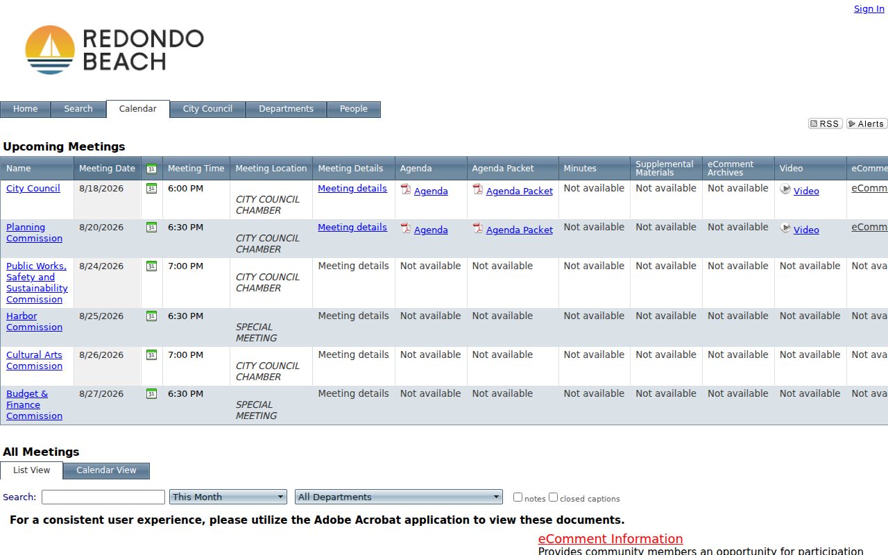
Keep permit names, contractor names, civic participants, and property parties in different evidence columns. The separation protects the street search from turning one address clue into an unsupported household story.
Redondo Beach Voter Records
California My Voter Status and the Los Angeles County voter-status tools are personal verification services. They can help a voter check registration information, but they are not public name-and-address directories for a Redondo Beach street. A full voter file is purpose-gated under Elections Code §2194. The research specifically found no lawful public by-street roll that can be browsed to list every registered voter at each parcel.
The California voter status lookup is the proper first link for a person checking their own record. A separate Secretary of State voter-file request page describes the restricted route for election, scholarly, journalistic, political, or governmental purposes. The application asks for the applicant, represented entity, purpose, security plan, jurisdiction, specific voter identifiers, delivery details, signature, and supporting material. It is submitted with a wet signature by mail, courier, or in person, not by email or fax.
The statewide file fee is $100. A specific-record request is $30 each up to $100 and requires full name, date of birth, county, and residence address. Published Los Angeles County rates include $146 countywide, $54 for a precinct, district, or city file, and $39 for an added file, with delivery on CD. Unauthorized acquisition or use can trigger Elections Code §18109. Safe at Home voters are protected, and driver-license address data is restricted by the federal Driver's Privacy Protection Act.
Trace Redondo Beach Tracts Across Street History
Redondo Beach street names make more sense when read through tract history. Clifton-by-the-Sea opened in 1906 with Avenues A through I south of the original townsite. Redondo Villa tracts opened in 1906 and 1907 and were annexed in 1927. Hollywood Riviera's historical identity reaches into present Torrance and the 90505 area. Those facts explain why a familiar community label can lead outside the modern city boundary.
There is no authoritative citywide date for a Redondo Beach street-renumbering project in the research. Do not fill a gap with a neat conversion table. Compare the original street form, cross streets, tract or lot, AIN, parcel geometry, and the closest directory or map edition. A legal description can preserve continuity when a postal line or neighborhood name changes.
The two ordinary delivery ZIP geographies also help with orientation, but they do not settle municipal identity. USPS delivery, assessor situs, city permits, election precincts, and recorder legal descriptions serve different purposes. Hollywood Riviera and the narrow connection between North and South Redondo make it especially important to verify the parcel instead of treating a ZIP or community name as a city-limit test.
Redondo Beach Address Trails for Family History
A Redondo Beach street directory can support a family-history question without pretending to name everyone who used a house. Start with an address tied to a known relative, then preserve the parcel facts, deed parties, and dated directory or phone-book listing as separate clues. The census through 1950 can supply a household snapshot, while newspapers, probate, permits, and yearbooks can explain a move or a name change. Each source should keep its own date and evidence label.
When the task shifts from the street to the historical volumes themselves, the Redondo Beach city directory collections provide the year runs and shelf instructions. That route is useful for locating a printed name or address in the nearest held volume. It does not turn a missing volume into proof that a family was absent. A prior and later listing bracket the gap, while a deed or newspaper may identify an event between them.
Redondo Beach's record history rewards an era ladder. Early maps and newspapers support the original townsite and 1900s tracts. City directories and permits add detail from the early twentieth century. Phone books, census pages, and postwar records extend the trail. For a modern address, the assessor and current city request route should lead, with historical sources used to test rather than replace the current parcel match.
Redondo Beach Street Directory Privacy
Address records leave major parts of a household outside public search. Utility customers, delivery data, unlisted subscribers, household members, and people who use a place without owning it do not form a public parcel field. The assessor's mailing line may point away from the situs. DMV address data is closed by the federal DPPA and California law. A voter record has its own purpose limits, and a Safe at Home participant can use a substitute address without erasing older records.
Lawful personal use. Redondo Beach property and address records may support personal research, family history, and civic questions. Do not use a street directory or any linked record to stalk, harass, intimidate, expose, or harm a person. California restrictions on voter files, DMV data, and protected addresses still apply even when a parcel is easy to locate.
The Secretary of State's Safe at Home information explains the substitute-address program for qualifying survivors and other eligible participants. It does not delete old public records, but it is a direct reason that a nearby person may be absent from a lawful search. Civil Code §5216 also supports redaction of a protected participant's name, property address, and email from an association directory or access system.
A sound Redondo Beach street directory therefore ends with a boundary, not a guess. Report what the parcel, deed, permit, or dated listing says. Mark what the source cannot show. If a record is important, contact the custodian through its current official channel and check the legal description or record identifier before relying on it.